Recent Work
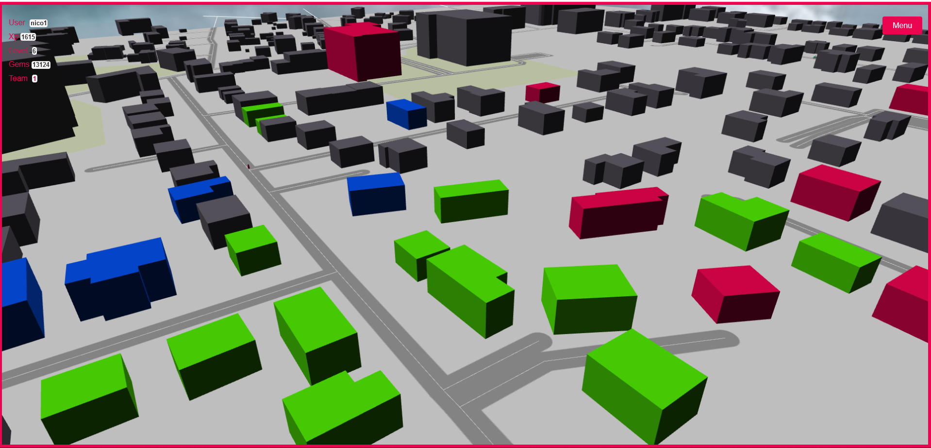
GIS Game
Open geo-data, geolocalisation, gamification. Let us bundle it all together and have fun. Take care! Ghosts are chasing you...
Open Street Map Postgis Python Geopandas React.js Babylon.js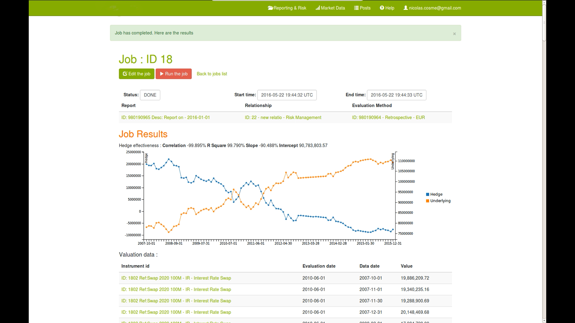
Financial Instruments Reporting
SaaS for CFO’s and finance professionals to value interest rate and forex instruments and test hedging strategies.
Postgresql Ruby Ruby-on-Rails C++ SWIG d3.js AWS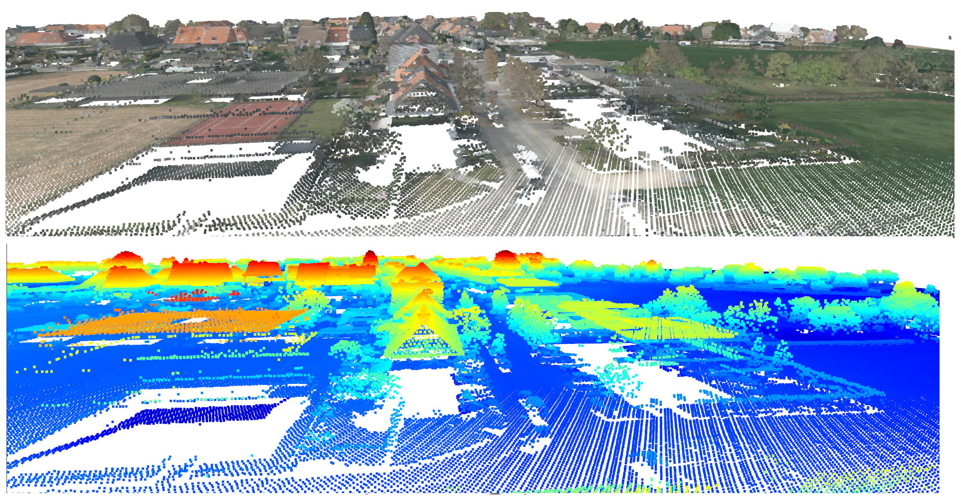
LIDAR data
3D buildings, Digital terrain model, data segmentation
Python GIS AWS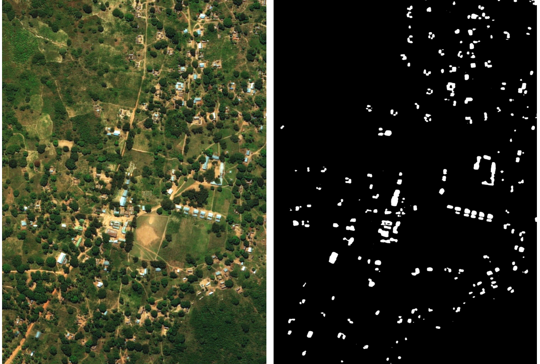
Aerial Images Segmentation
Cadasters in underdeveloped countries are rares and when existing uncompletes or not up to date. Yet cadasters are important for development planification. It can be efficiently built from aerial images by applying segmentation techniques with deep neural networks.
Python Tensorflow Keras Docker AWS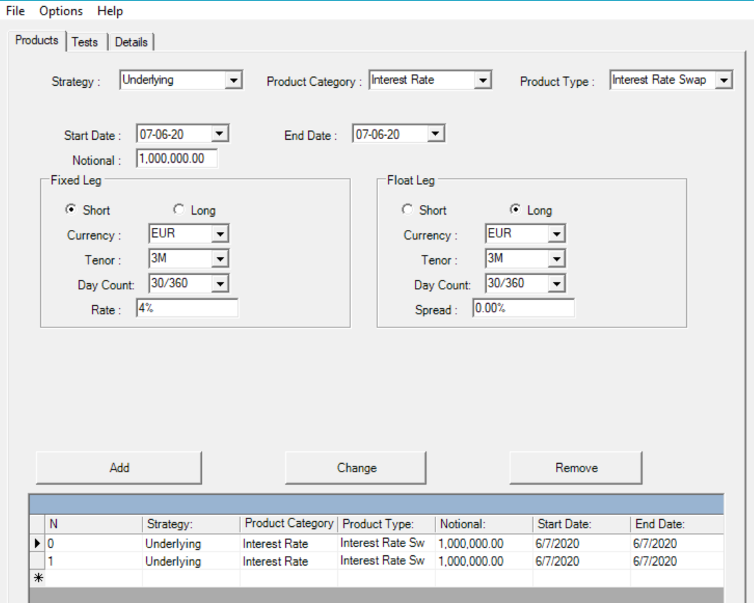
IFRS 7
Hedge accounting under IFRS 7 required specific quantitative testing. A handy solution was developed to integrate historical data and valuation methodologies.
C++ .NET COM Interop